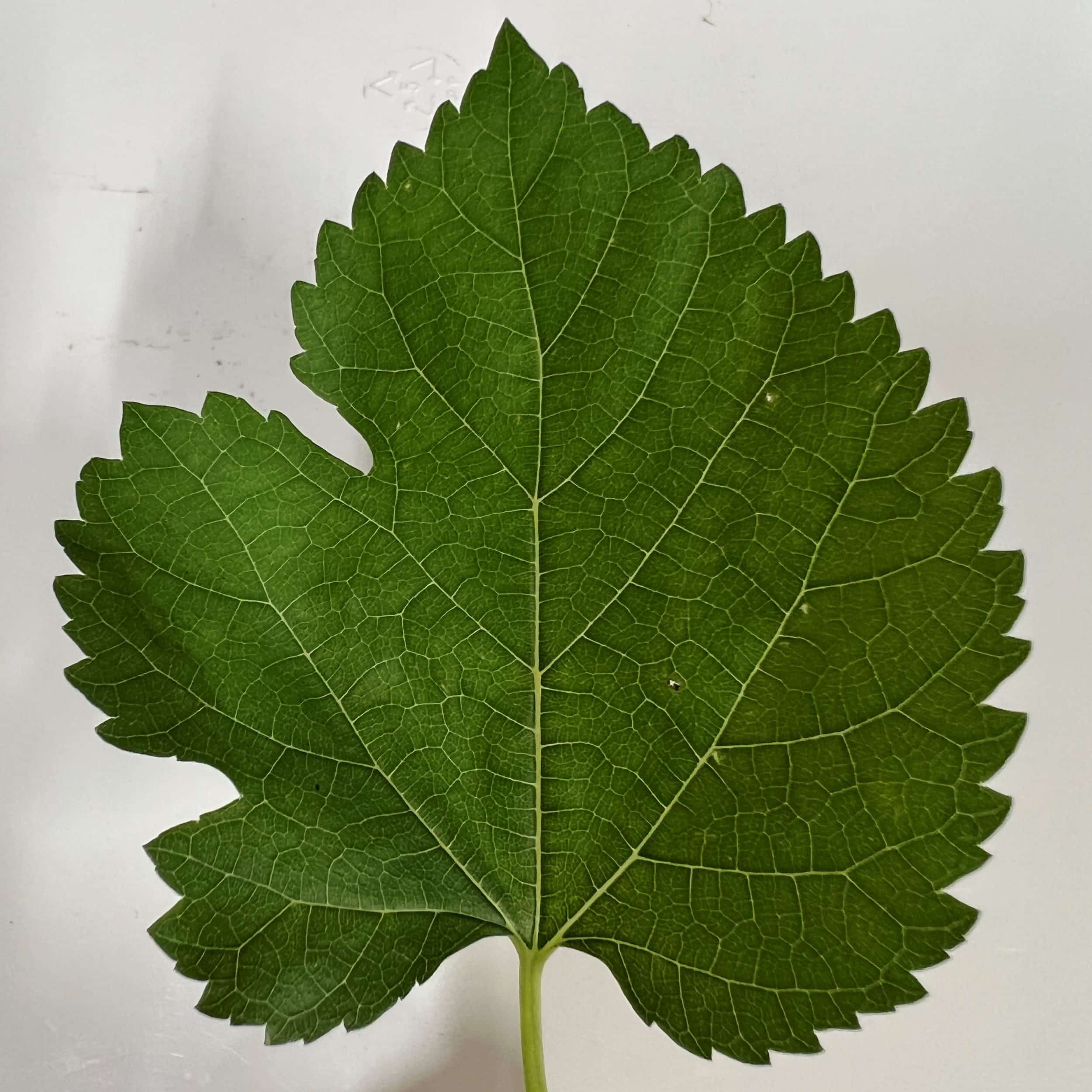
The concept of a watershed can be overwhelming to comprehend. We may recognize pieces and parts, but the whole is often abstract in our minds. As with many concepts, a visual example helps, and in this case, is found in the venation of leaves.
Beginning with the petiole, which represents the discharge point of a watershed, the main vein is the river for which watersheds are named. Secondary veins represent tributaries, that are further divided into increasingly smaller streams that flow from the edges of the leaf.

The tissues between veins are the wetland and upland habitats within the watershed. The leaf edges denote the boundaries of one watershed from the next. In the natural world, these boundaries are ridges in the landscape that direct rainwater in more than one direction, downhill into watersheds on either side.
And yes, the world we know is divided into countless watersheds of whatever size we choose to define. The discharge point is the key to defining any given watershed. The Mississippi River watershed, for example, flows to the mouth of the river, discharging water into the Gulf of Mexico from lands that cover 1.2 million square miles. Water flows across this area through countless rivers and streams.
Smaller watersheds within this larger one can be defined by selecting any point of discharge along the way. Using the leaf as an example, the veins and tissues that lie above any one point, ending at the boundary of the leaf, constitute a defined watershed – ad infinitum.
As a young Boy Scout and later as an Adopt-A-Stream volunteer, I learned to read topographic maps to find rivers and streams, depicted by blue lines, and trace them to where they end, that marked the edges of a watershed. Inevitably, a nearby blue line began, heading in another direction – part of an adjacent watershed. With patience, you can draw a line between these stream ends to show the boundaries of any watershed – down to your chosen discharge point.
The water falling within a watershed may be absorbed by vegetation and soil, evaporate into the atmosphere, seep into the groundwater, or flow across the landscape into those ever-increasing-sized channels, ending at the discharge point. And that is the definition of a watershed – a defined area through which water flows to a certain point.
Finding the boundaries of the watershed within which you live is a challenge to master but is a great step toward understanding how water moves across our landscape and our role in the process.
Hope to see you in our great outdoors!
Photos and graphics by Mark W. LaSalle